Caving
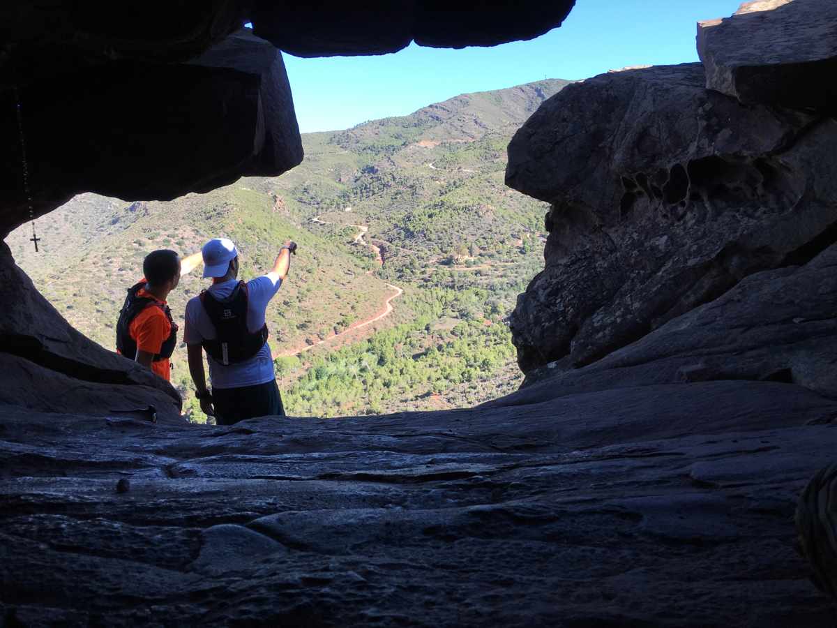
If Serra’s surroundings are one of a kind, its subsoil is no less attractive. More than 50 underground cavities, caves and potholes are scattered throughout Serra’s domains. Their dimensions, type and shape vary, but all of them are part of the subterranean ecosystem where different species of animals live: from bats to insects, to arachnids and crustaceans adapted to extreme conditions (absolute darkness, a temperature with almost no variations and a high degree of humidity). In addition to natural caves, there also artificial cavities, such as mines.
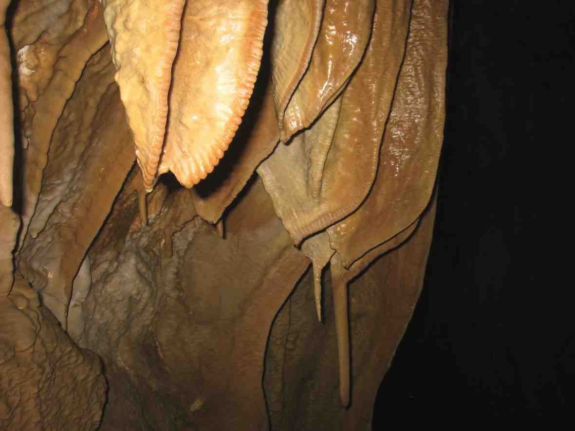
Serra’s caves were one of the first to be explored by cavers in València. This is not strange, since the biggest cave of Serra Calderona (and one of the biggest of the province of València) is located in Serra: it is almost two kilometres long. In Serra there is also the deepest cavity of Serra Calderona: the pothole of Muladar, which is more than 137 metres deep.
The most representative caves are:
Cave of Soterranya
Location: In the area of the Porta Coeli charterhouse. It can be accessed by the forestry track that starts at the crossroads between CV-331 and CV-328. Continue on the forestry track and follow the signs towards the spring of L’Abella: Next to the remains of an old animal pen, there is a small gully that runs parallel to a forestry track: when they meet in the east, at the top of a small hill, you will find the cave’s opening.
Entrance: It has eight openings, seven of them grouped around a sinkhole.
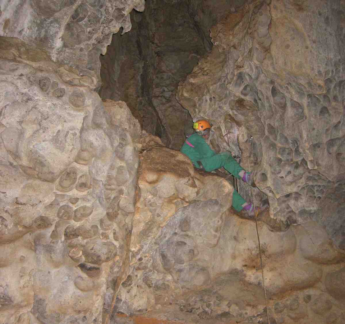
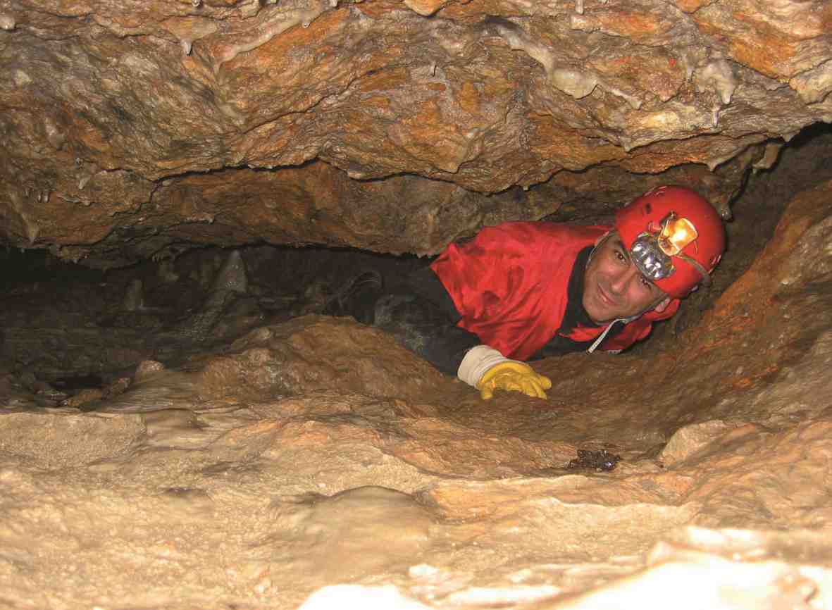
Cave characteristics: Length: 1,810 metres. Depth: 100 metres. This is the second largest cavity in the Valencian Community. You do not need a flashlight nor a headlamp not any equipment to visit the first chamber. To visit the rest, however, you need specialized caving equipment.
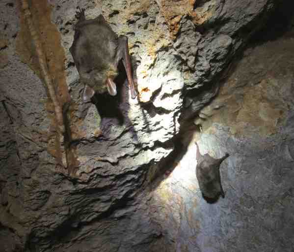
Its main highlight are the colonies of bats in danger of extinction that inhabit it. That is why the cave is closed during certain periods of the year. In the depth of this cave, there exists a species of beetle unique in the world: Microtyphllus Infernalis. Thieves used to take shelter in the cave of Soterranya. It is also said that after the Spanish Civil War, a group of Maquis hid in there and they were never found by the Civil Guard.
K-28
Location: The cave is by the CV-310 road to Torres-Torres: you will find it after passing by the 28 kilometre milestone, on the left side of the road.
Entrance: It has a main entrance of 1,2 x 4 metres wide. It has a small slope that ends with a pothole of 7 metres deep.
Cave characteristics: Length: 200 metres. Depth: 35 metres. You can only visit it properly equipped for caving practice.
Cave of L’Alt del Pi or cave of Les Aranyes
Location: In the south-eastern slope of the mountain of L’Alt del Pi and a few metres away from the forestry track that goes up to the top.
Entrance: It has a rectangular opening which leads to a slightly descending gallery of 20 metres long.
Cave characteristics: Length: 130 metres. Depth: 53 metres. You can only visit it properly equipped for caving practice.
Mina de Plata
Location: It is in the Rebalsadors mountain, 500 metres away from the cave of Rebalsadors.
Entrance: It has an entry of 5 x 3 metres wide that opens to a series of galleries heading to east.
Cave characteristics: Length: 105 metres. The galleries are horizontal, and their width and height vary between 2 and 3 metres. It is an old mine of galena (lead glance), a type of lead sulphide with varying amounts of impurities, and with a silver content that can reach 1 %. You can only visit it properly equipped for caving practice.
Cova de Rebalsadors
Location: Near to the top of the Rebalsadors mountain.
Entrance: Its opening leads to a small-sized cavity.
Cave characteristics: Length: 60 metres. Depth: 36 metres. You can only visit it properly equipped for caving practice.
Pothole of Pla de les Llomes
Location: It is on the CV-334 road from Serra to Barraix, around 40 metres to the right after passing the machine-gun nests from the Spanish Civil War.
Entrance: it as a 2 x 1 metres opening which leads to a 11 metres deep pothole.
Cave characteristics: Length: 220 metres. Depth: 42 metres. You can only visit it properly equipped for caving practice.
Pothole of Muladar
Location: The pothole of Muladar is in the upper part of the gully of Muladar, in the eastern slope of the Campillo hill, 382 above sea level. It is the deepest cavity of Serra Calderona.
Entrance: The entry leads to a small chamber where you will find the starting point of the descent.
Cave characteristics: Length: 250 metres. Depth: 137,5 metres. Total vertical distance: 368 metres.
The pothole has a north-south orientation and a huge size compared to the other caves and potholes of this mountain range. This cave was unblocked, explored and mapped by geologists Policarp Garay, Eduardo Picó, Juan Carlos Alegre and Vicent Esteve from 2005 to 2008. You can only visit it properly equipped for caving practice.
Cave of Inés
Location: It is located at the top of the hill known as ‘El rodeno de Santa Agnés’, in the vicinity of the Porta Coeli charterhouse, at 492 above sea level.
Entrance: The small entry measures 1,5 x 0,5 metres and leads to a small chamber.
The small cave is name after the anchorite Inés Pedrós, who was born on the 23th of June 1388 in the neighbouring town of Moncada (Horta Nord county). The story says that Inés was a very devout child, who had visions of Jesus during the Holy Communion. Inés’ family wanted to marry her to a young man from the village against her will: she wanted to give her life to God instead. And so, 15-year-old Inés fled from home dressed as a man and entered in the Porta Coeli charterhouse. She worked there for a while growing crops. When her true gender was discovered during a confession, she was expulsed from the charterhouse and she was allowed to live in a cave nearby. From there she could take care of the cattle and lead a hermit life dedicated to silence and praying. From that first cave she went to the one which currently carries her name. She lived there for twenty years until she passed away on the 25th of July in 1428.
Shepherds from that time used to say that, the night the venerable Inés died, they saw a blaze of fire coming down from the sky to the cave where the shepherd of the charterhouse’s cattle (as they believed her to be) was living. Inés’ body was brought to the charterhouse to be buried. During the preparation of the body for her burial, her true identity ─that young girl from Moncada who had visions of Jesus─ was discovered. The story says that the bell of the convent would not stop tolling during the funeral, until the point of breaking. The bell had to be melted down and remade. The name of Inés is still present in the charterhouse. A vigil was hold in the charterhouse church and they say that, whoever touched her remains, was healed for any ailments they had.
Her burial site, under the altar of the communion chapel, and the cave where she had lived became popular places for pilgrims and devotees for over three centuries. It reached a point where the massive affluence of people started to disrupt the silence and loneliness the Carthusian monks were bound to. And so, they decided to move the body of Inés to the cemetery and her remains ended up confused with that of the rest of the monks. The cave is still visited today by monks and believers. Inside it, there is a sort of altar with many sorts of objects.
For more information about the practice of this sport, click on the following link: